New website coming soon!
Look for a completely refreshed website in the summer of 2026!
Have you ever been on a road trip? If you have, you know you need places to stop for things like fuel, food, and lodging. The same is true for birds during migration! Large numbers of ducks, geese, swans, and other waterbirds stop on the Upper Mississippi River National Wildlife and Fish Refuge (refuge) to rest and feed as they travel. The refuge has special use areas which provide safe stopover places where birds can rest from their flights. In addition to being closed to all migratory bird hunting, special use areas are closed to all other hunting activities, trapping, and camping during the state waterfowl hunting season in their respective states. Some special use areas are also labeled as voluntary avoidance areas and/or no motor areas.
We’re asking all boaters to help give wildlife a rest by keeping boats outside of Voluntary Waterfowl Avoidance Areas on the refuge. Allowing birds to rest and feed gives them a better chance of making it to their winter habitat with enough body fat to survive. In the La Crosse District, voluntary waterfowl avoidance areas are located on parts of Navigation Pools 7 and 8 of the Mississippi River.
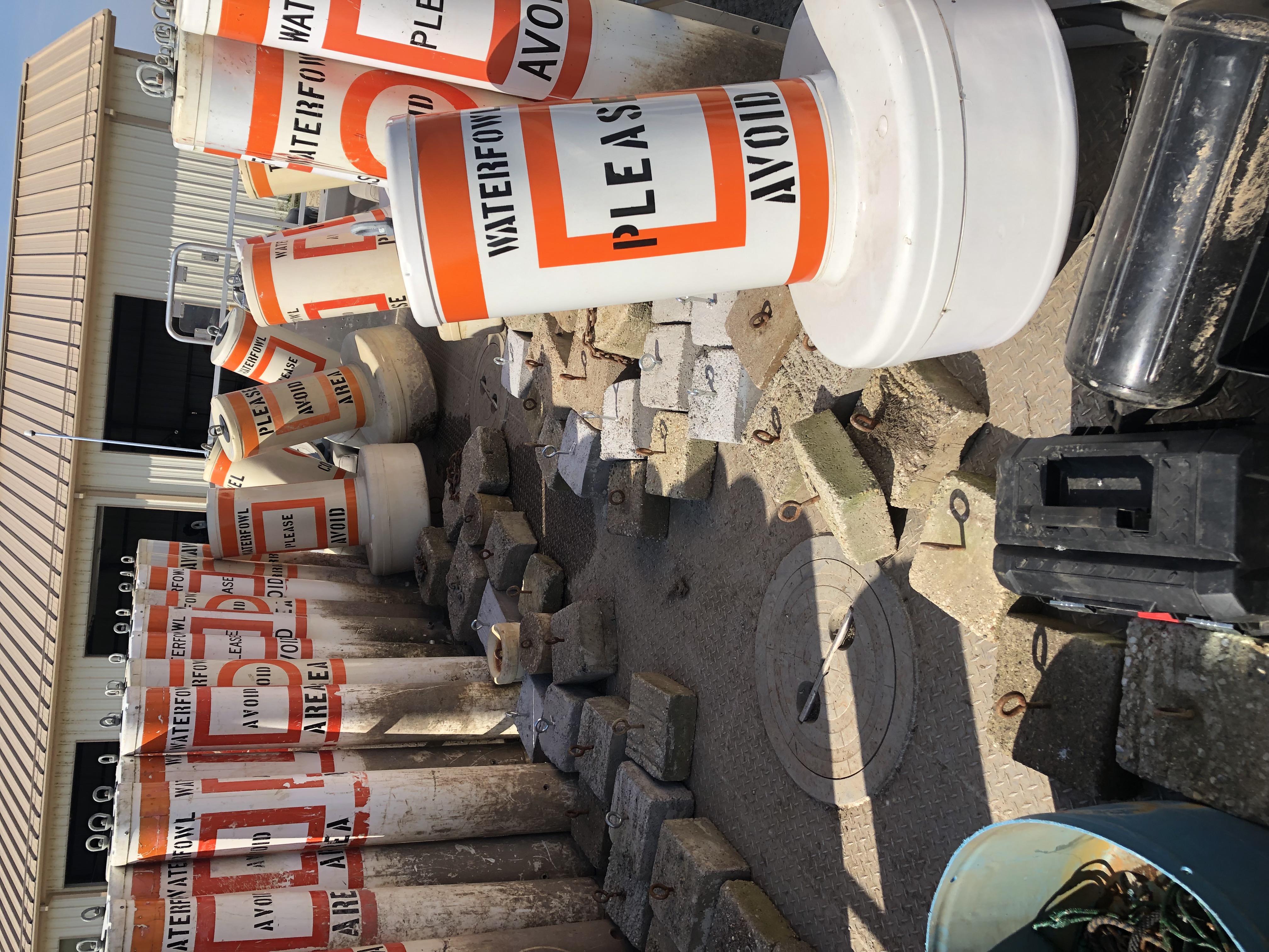
Voluntary Waterfowl Avoidance Area in Navigation Pool 7: The avoidance area on Lake Onalaska is marked with orange-and-white buoys, covering a 3,356-acre section of the lake. The plants that grow in this area are a critical food source for diving ducks, especially canvasback ducks. The Voluntary Waterfowl Avoidance Area is in effect from October 15 through mid-November.
A team from the U.S. Geological Survey has monitored boater compliance with the Lake Onalaska Voluntary Waterfowl Avoidance Area over several years. The good news is that many boaters respect the voluntary avoidance area. However, boats continue to enter the area and overall daily disturbances to birds continues to be above allowable levels.
Voluntary Waterfowl Avoidance Areas in Navigation Pool 8: All boaters are also asked to avoid entering the 984-acre Goose Island No Hunting Zone and the 6,538-acre Wisconsin Islands Closed Area, both located in Pool 8. To further reduce disturbance to waterfowl concentrated in the Goose Island No Hunting Zone, the use of motors is also prohibited. Thousands of puddle ducks, diving ducks, tundra swans, and American white pelicans use this section of the river as their “rest area”. The Voluntary Waterfowl Avoidance Areas are in effect from October 15 through the end of the state duck season.
Orange and white buoys will also be placed in Pool 8 to alert boaters of these areas.
In addition to the many individual boaters who have made this program successful since its beginning in 1986, program partners include the Lake Onalaska Protection and Rehabilitation District, La Crosse County Conservation Alliance, Wisconsin Department of Natural Resources, University of Wisconsin-La Crosse, U.S. Army Corps of Engineers, U.S. Geological Survey, and U.S. Fish and Wildlife Service.
For more information visit our webpage: http://www.fws.gov/refuge/upper-mississippi-river/